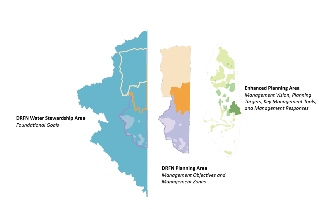
The DRFN Planning Area is the area within which DRFN is focusing its land use planning. It is within a larger Water Stewardship Area which includes key watersheds that are directly linked to the DRFN Planning Area. Activities in the Water Stewardship Area can have downstream impacts that become apparent within the DRFN Planning Area.
The DRFN Planning Area is made up of:
• Management Zones – Areas that reflect the varying conditions, constraints, and opportunities that are found throughout the Planning Area. Each Zone has a management vision, planning targets, disturbance thresholds, and management responses.
• Enhanced Planning Areas – Areas that have high cultural and ecological significance, and must be in a healthy condition and largely undisturbed for DRFN members to be able to practice their Treaty Rights in a meaningful way.
• DRFN Community Lands – Important lands that DRFN holds, such as reserve lands, Treaty Land Entitlement lands, and privately owned lands.
Additional detail on the DRFN Planning Area can be found within the DRFN Land Use Plan found here.
The Joint Land Use Plan (JLUP) will cover the DRFN Planning Area. To learn more about the JLUP, click here.