DRFN peoples (Tsááʔ çhé ne dane) are descendants of the Dane-zaa who have occupied the Peace River region for thousands of years. Members seasonally traveled across the region in northeastern BC and northwest Alberta including, but not limited to the areas of Fontas, Chinchaga, Montney, Dawson Creek, Grande Prairie, TeePee Creek, Dunvegan and Clearhills. Today, these areas comprise a core part of DRFN’s territory. Tsááʔ çhé ne dane would hunt, gather, trap and continue their cultural practices with other Dane-zaa kinship groups. Archaeological evidence from the Charlie Lake Cave Site (Tse Kw’a) demonstrates that occupation in the area goes back at lease 11,000 years. Our members still actively use the land base for hunting, fishing, trapping, camping, cultural practices and exercising our treaty rights.
The community’s mission is to be present throughout its territory, assert its treaty rights, protect the land and manage its natural resources for the greatest benefit of Doig members. This will be accomplished by achieving the following objectives:
- Being active on the land base
- Ensuring treaty rights are understood, respected and upheld
- Properly using and managing DRFN’s territory, reserve and fee-simple lands, and
- Acquiring new lands within DRFN territory
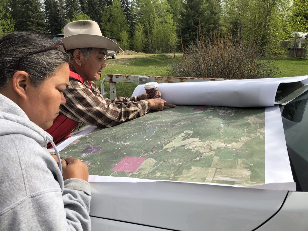
The DRFN Lands and Resources department actively engages in consultation activities with industry and government to ensure territorial integrity and that treaty implementation is maintained. The Lands department participates in many provincial and federal government initiatives around cumulative effects, wildlife management, land use planning, cultural heritage, water, oil and gas activities. DRFN sends out elders and monitors regularly to assess sites and report information to the Lands department.
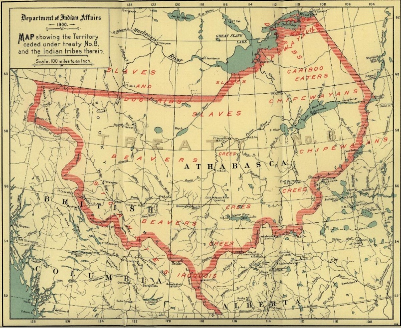
Treaty No. 8
When First Nations signed treaty 8, they were promised they could continue with their traditional ways of life “for as long as the sun shines, grass grows and the rivers flow”.
DRFN, as part of the original Fort St. John Beaver Band with Blueberry River First Nations, adhered to Treaty No. 8 in 1900. Treaty No. 8 encompasses a landmass of approximately 840,000 kilometres, is home to 39 First Nations’ communities, including 23 in Alberta, 3 in Saskatchewan, 6 in the Northwestern Territories and 8 in British Columbia. The Crown sought treaty with the First Nations in order to ensure access to miners during the Klondike gold rush.
Treaty No. 8 has been called, “one of the most important of the post-Confederation treaties,” by the Supreme Court of Canada (Mikisew Cree First Nation v. Canada [Minister of Canadian Heritage], 2005 SCC 69 at para 2).
Treaty No. 8 Western Boundary
In 2005, DRFN, along with several other Treaty 8 First Nations, jointly sought a declaration from the courts on the western boundary of Treaty No. 8. On September 25, 2017, the BC Supreme Court ruled in favour of the Treaty 8 First Nations that the western boundary of it is the height of land between the Arctic and Pacific watersheds. In May 2020, the BC Court of Appeal, also affirmed this decision in West Moberly First Nations v. British Columbia, 2020 BCCA 138, by dismissing the appeal by the Province of British Columbia and other First Nations. This is an important decision for DRFN as it affirms the ability for Treaty First Nations to ask the court for clarity about aspects of their historic treaties and provides clarity to government and industry on territory, territorial integrity and where Treaty First Nations manage their natural resources. We are grateful for the legal expertise of our shared legal counsel with Devlin Gailus Watson and Rana Law who have successfully brought this case forward and defended our interests on the appeal. The case summary can be found here on the Devlin Gailus Watson website.
DRFN Lands
DRFN has a combination of current and future reserve lands as well as fee simple holdings in and around Doig River First Nation and Fort St. John.
What is Reserve Land?
In Canada, an Indian reserve is specified by the Indian Act as a “tract of land, the legal title to which is vested in Her Majesy, that has been set apart by Her Majesty for the use and benefit of a band.” In 1867, legislative jurisdiction over “Indians and Lands reserved for the Indians” was assigned to the Parliament of Canada through the Constitution Act, 1867, a major part of Canada’s Constitution, originally known as the British North America Act (BNA), which acknowledged that First Nations had special status. Separate powers covered “status and civil rights on the one hand and Indian lands on the other.”
The Indian Act gives the Minister of Indigenous Affairs the right to “determine whether any purpose for which lands in a reserve are used is for the use and benefit of the band.” Title to land within a reserve may be transferred to only the band or to individual band members and reserve lands may not be seized legally, nor is the personal property of a band or a band member living on a reserve subject to “charge, pledge, mortgage, attachment, levy, seizure distress or execution in favour or at the instance of any person other than an Indian or a band” (Section 89 (1) of the Indian Act).
DRFN Reserve Land
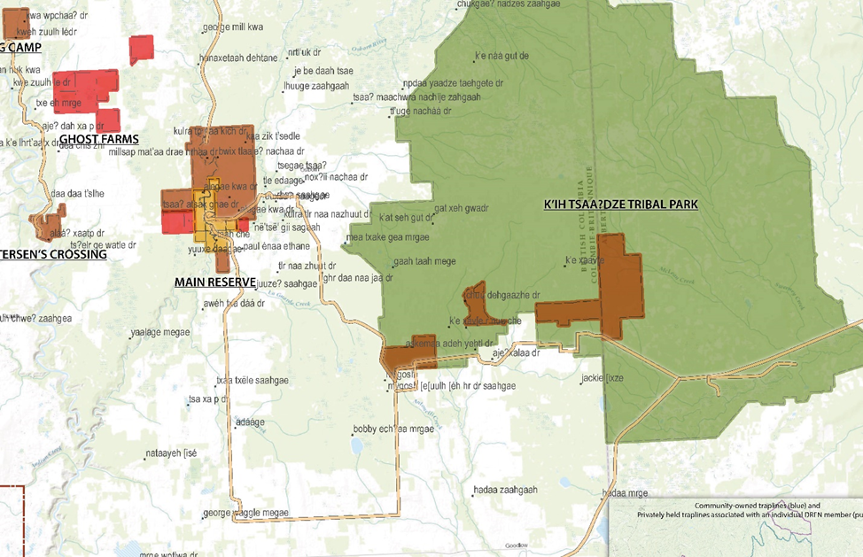
Hanás Saahgéʔ (Main Reserve)
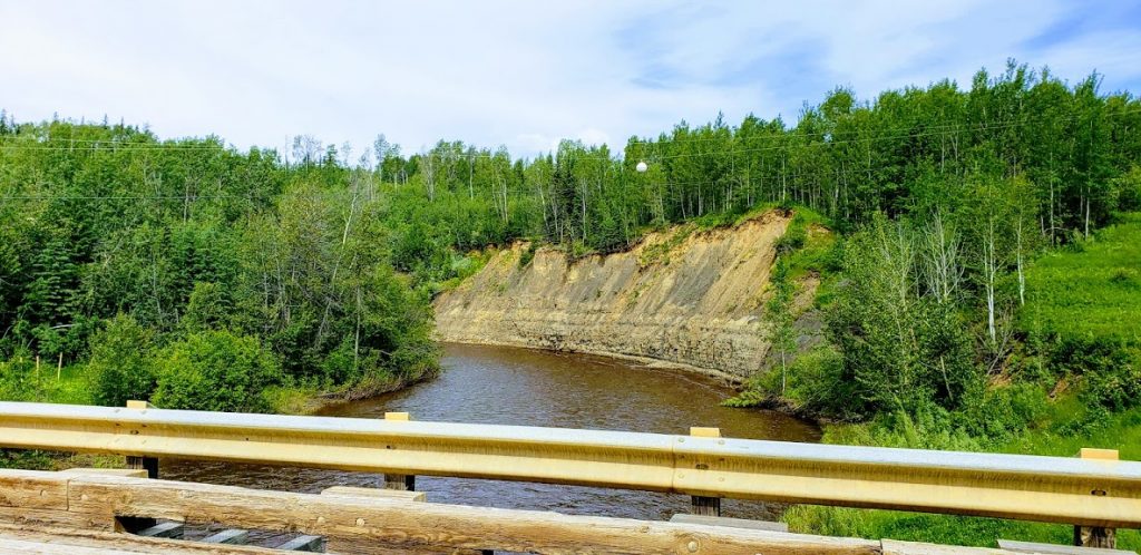
This is the name for the main reserve Doig River I.R. # 206 and it means “Raft River”. The Doig River has always been an important camping area in DRFN’s seasonal rounds. DRFN was relocated here in 1950.
Moig Flats (Beatton River)
The north half of Beatton River I.R. # 204. This IR is shared with Blueberry River First Nations. This is an important cultural site to DRFN.
Future DRFN Reserve Lands
Alááʔ Saṯǫ (Petersen’s Crossing)
“TLE” land selection at Petersen’s Crossing. This means “Raft Sitting There”. Many of the Nation members lived and went to school here after the Montney reserve was taken from the community. This is the second largest year-round settlement.
Tsazuu̱lh Saahgáe (Big Camp)
TLE land selection east of I.R. # 204. This means “Big Timber Creek”. It is located on one of DRFN’s main pack trails that follows the Beatton River.
K’ih tsaa?dze Tribal Park
A large area east of the main community that has been declared a Tribal Park by DRFN. Several TLE land selections are located within this Tribal Park.
Old Fort Properties
300+ acres on the Old Fort Road to be used for future cultural purposed and reserve creation.
Fort St. John Properties
Three parcels of land; 8, 7 and 6 acres each, that are currently zoned industrial, residential and commercial development but are in process with Canada for reserve creation.